Χάρτες Καταλληλότητας Εδάφους για τη διασπορά αποβλήτων κατεργασίας κελυφωτών φυστικιών
By Dr. Maria K. Doula
Benaki Phytopathological Institute
- General aspects
- Land Suitability Maps for Solid Pistachio Waste Landspreading
- Land Suitability Maps for Pistachio Wastewater Landspreading
- References
- How data should be cited
- Contributors
Σημείωση: Οι όροι "οργανικά υλικά", "απόβλητα" ή και "γεωργικά απόβλητα" που αναφέρονται και αξιολογούνται με τη χρήση του CMS του Agrostrat, περιλαμβάνουν όλους τους τύπους υλικών, υψηλής περιεκτικότητας σε οργανική ύλη, τα οποία παράγονται από διάφορες γεωργικές πρακτικές (αγροτικές και κτηνοτροφικές) κατά τη διάρκεια της επεξεργασίας των φυτών και των καρπών, ενώ δεν περιλαμβάνουν κανενός είδους ζωικό ή βιομηχανικό υπόλειμμα. Προέρχονται αποκλειστικά από τον πρωτογενή και δευτερογενή γεωργικό τομέα, όπως για παράδειγμα απόβλητα επεξεργασίας κελυφωτών φιστικιών, απόβλητα ελαιοτριβείων, κοπριές.
Το Λογισμικό Διαχείρισης Καλλιέργειας και το Σύστημα Κεντρικής Παρακολούθησης & Διαχείρισης, που κάνουν χρήση των Χαρτών Καταλληλότητας Εδάφους, έχουν σκοπό την παροχή συμβουλευτικής και σε καμία περίπτωση να υποκαταστήσουν τις αρμόδιες ελεγκτικές αρχές. Συστήνεται η επικοινωνία και συμβουλή των αρμοδίων αρχών πριν τη χρήση αποβλήτων στο έδαφος.
General aspects
According to the United Nations Food and Agriculture Organization-FAO (1976):
Land evaluation is the process of estimating the potential of land for alternative kinds of land use so that the consequences of change can be predicted, while
Land suitability is the fitness of a given area for a land utilisation type (or land use), or the degree to which it satisfies the land user. It is generally presented as a class or rating.
Where a landscape characteristic does not meet the requirements for a particular land use, it constitutes a potential limitation or ‘constraint’. Constraints are commonly rated to express the degree of severity to which they may impair land use. Internationally recognised suitability classes outlined by FAO can be adapted and applied at both regional and local scale. Adapted FAO (1976) suitability classes, as cited in Van Gool (2008), are presented in Table 1.
Table 1. Land Suitability Classes (FAO, 1976)
|
Suitability Classes |
Description |
|
S1 Highly Suitable |
Land having no significant limitations to sustained application for a given land use or only minor limitations. Nil to minor negative economic, environmental, health and/or social outcomes. |
|
S2 Moderately Suitable |
Land having limitations which in aggregate are moderately severe for sustained application of a given land use. Appreciably inferior to S1 land. Potential negative economic, environmental, health and/or social outcomes if not adequately managed. |
|
S3 Marginally suitable |
Land having limitations which in aggregate are severe for sustained application of a given use. Moderate to high risk of negative economic, environmental, health and/or social outcomes if not adequately managed. |
|
N1 Not Suitable |
Land having limitations, which may be insurmountable. Limitations are so severe as to preclude successful sustained use of the land. Very high risk of negative economic, environmental and/or social outcomes if not managed. |
|
N2 Not Suitable |
Land having limitations which appear so severe as to preclude any possibilities of successful sustained use of the land in the given manner. Almost certain risk of significant negative economic, environmental and/or social outcomes |
For the purpose of pistachio waste landspreading, the FAO principles and guidelines were conformed to the specific circumstances while generally accepted restrictions for waste landspreading have been considered, as well (MAFF, 1989; Soil Science Society of America, 1986).
Factors considered for the definition of the parameters that should be assessed in cases of pistachio wastewater or solid waste landspreading are (1) physical and chemical characteristics of potential areas for waste landspreading (2) soil indicators that have been developed during AgroStrat Project for the evaluation of soil quality at pistachio cultivation and pistachio waste disposal areas (Doula et al., 2013), and (3) wastewater and solid waste properties.
The soil/area physical characteristics of concern are:
- Drainage
- Slope
- Soil depth
- Infiltration rate
- Erosion level
- On-site waste management (combines texture, soil depth, slope, surface gravel and drainage-Considered only for the case of wastewater)
- Salinity
The soil/area chemical characteristics and soil indicators (*) of concern are:
- Exchangeable Sodium Percentage (ESP)
- Cation exchange capacity (C.E.C.)
- Total Nitrogen*
- Available Phosphorus*
- Exchangeable Potassium*
- Available Copper*
- Available Zinc*
- Total Polyphenols*
*These soil parameters were defined during AgroStrat project as the most sensitive to describe changes in soil quality due to pistachio waste disposal.
Land Suitability Maps for Solid Pistachio Waste Landspreading
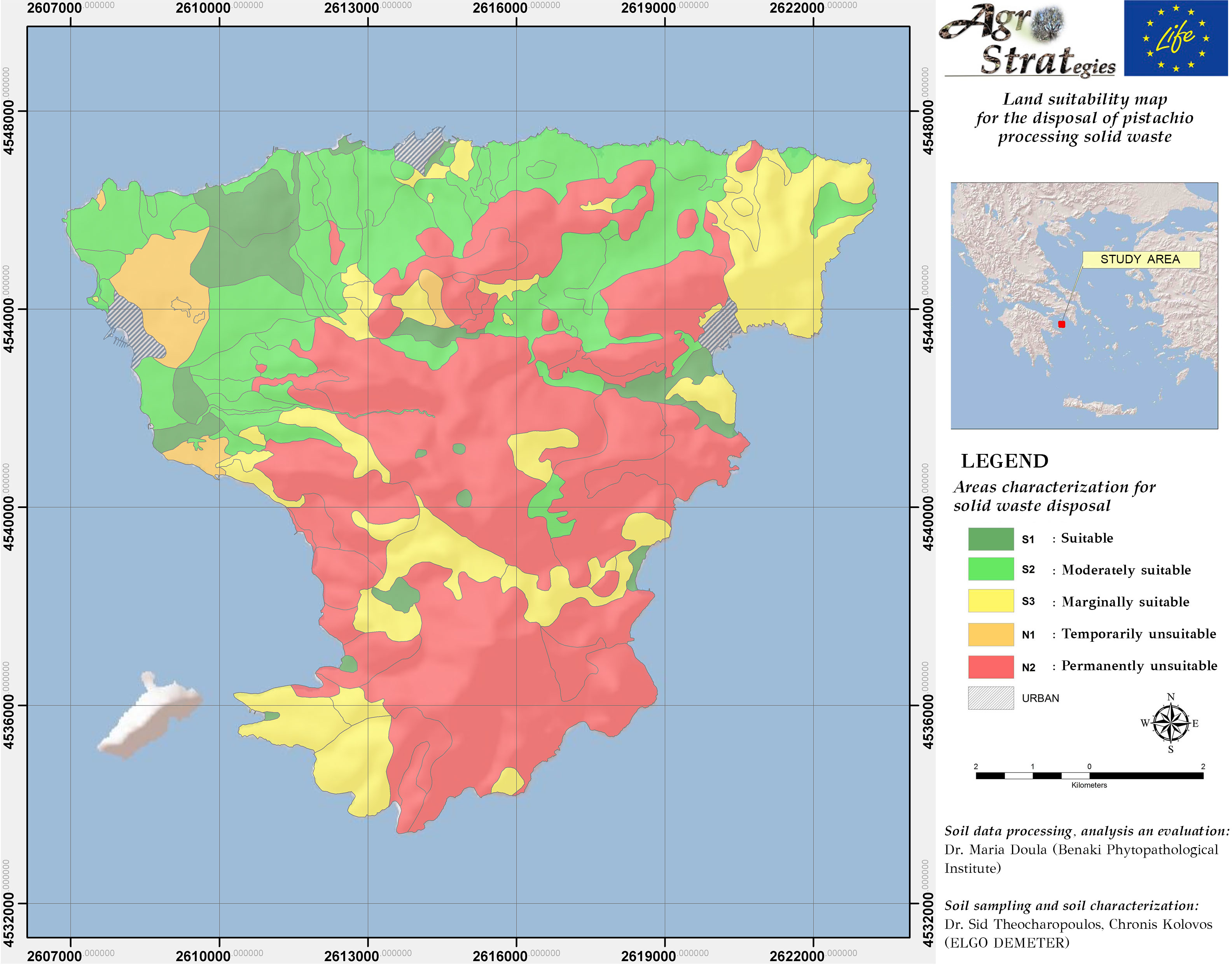
GIS maps were developed to assist the decision on the suitability of land to accept solid pistachio waste. Suitability maps were developed for each one of the soil parameters that were found to be affected mostly by pistachio wastes, as well as for the natural areas characteristics (i.e. slope, drainage, etc). Considering the specific limitations for these characteristics and parameters, the overall Land Suitability Map for solid pistachio waste land spreading was developed. Maps are included in the Cultivation Management Software to assist decision making regarding reuse or disposal of pistachio wastes.
Map 1: Land Suitability for landspreading of pistachio solid waste
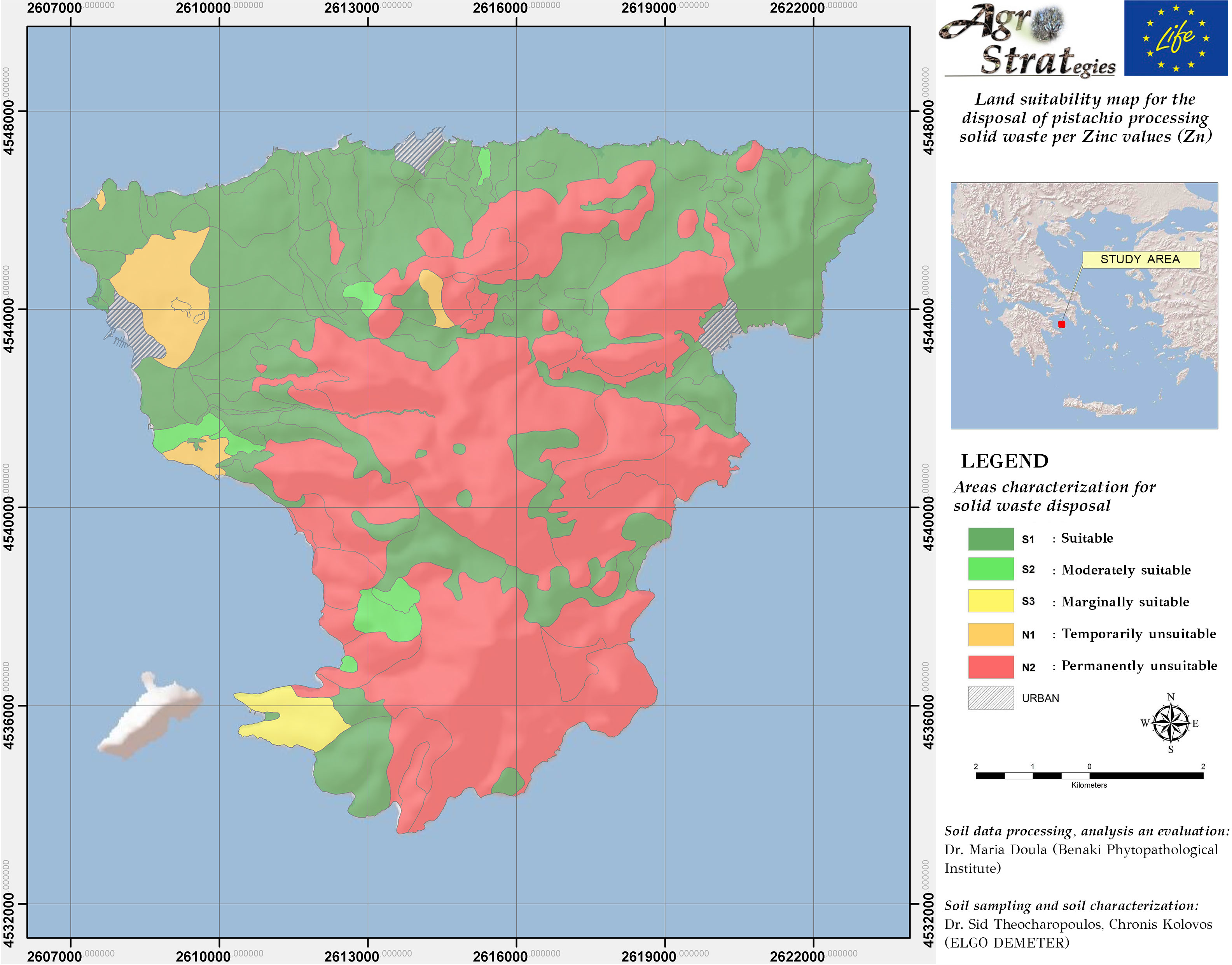
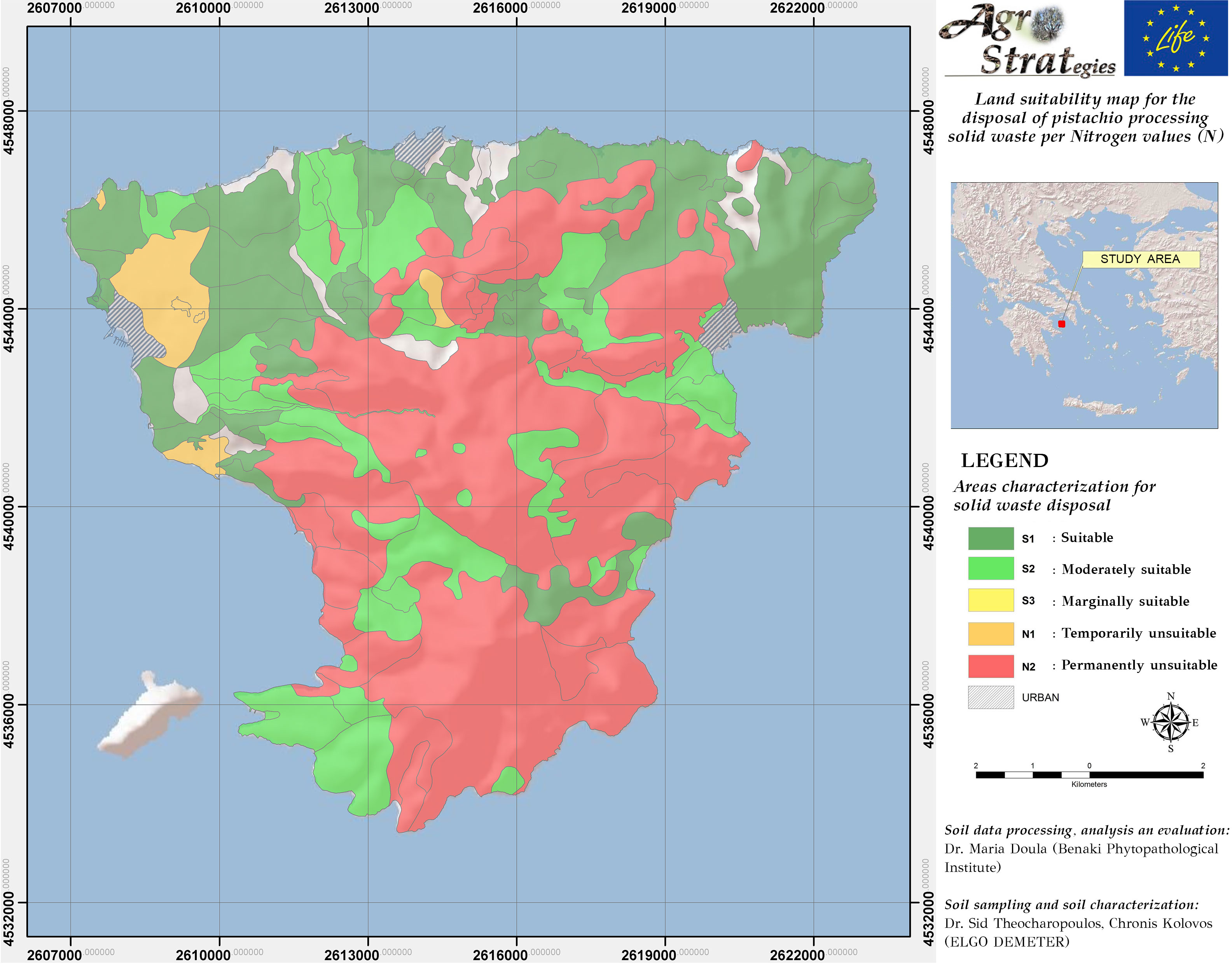
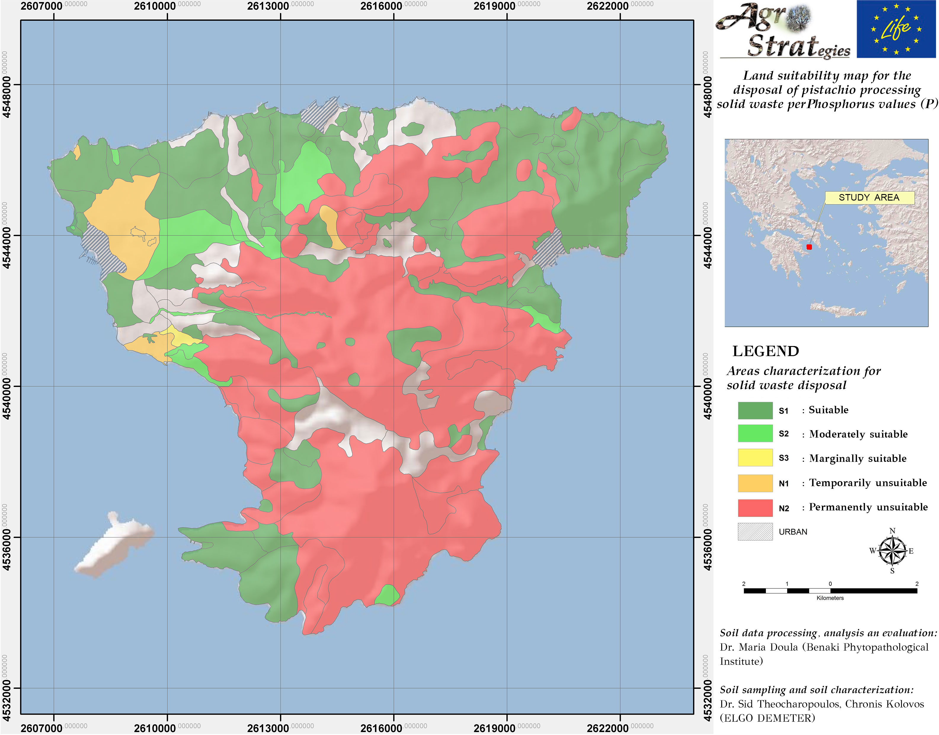
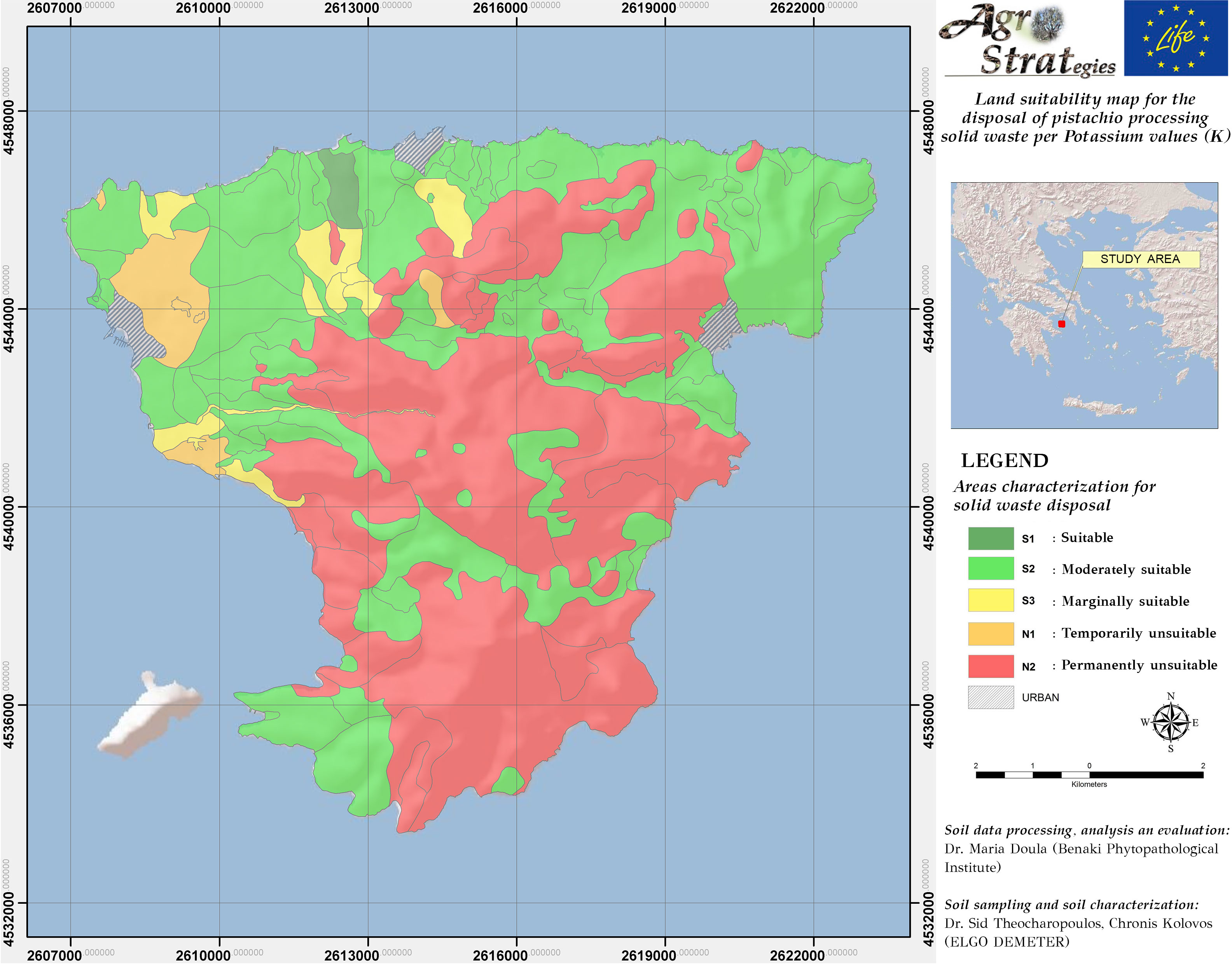
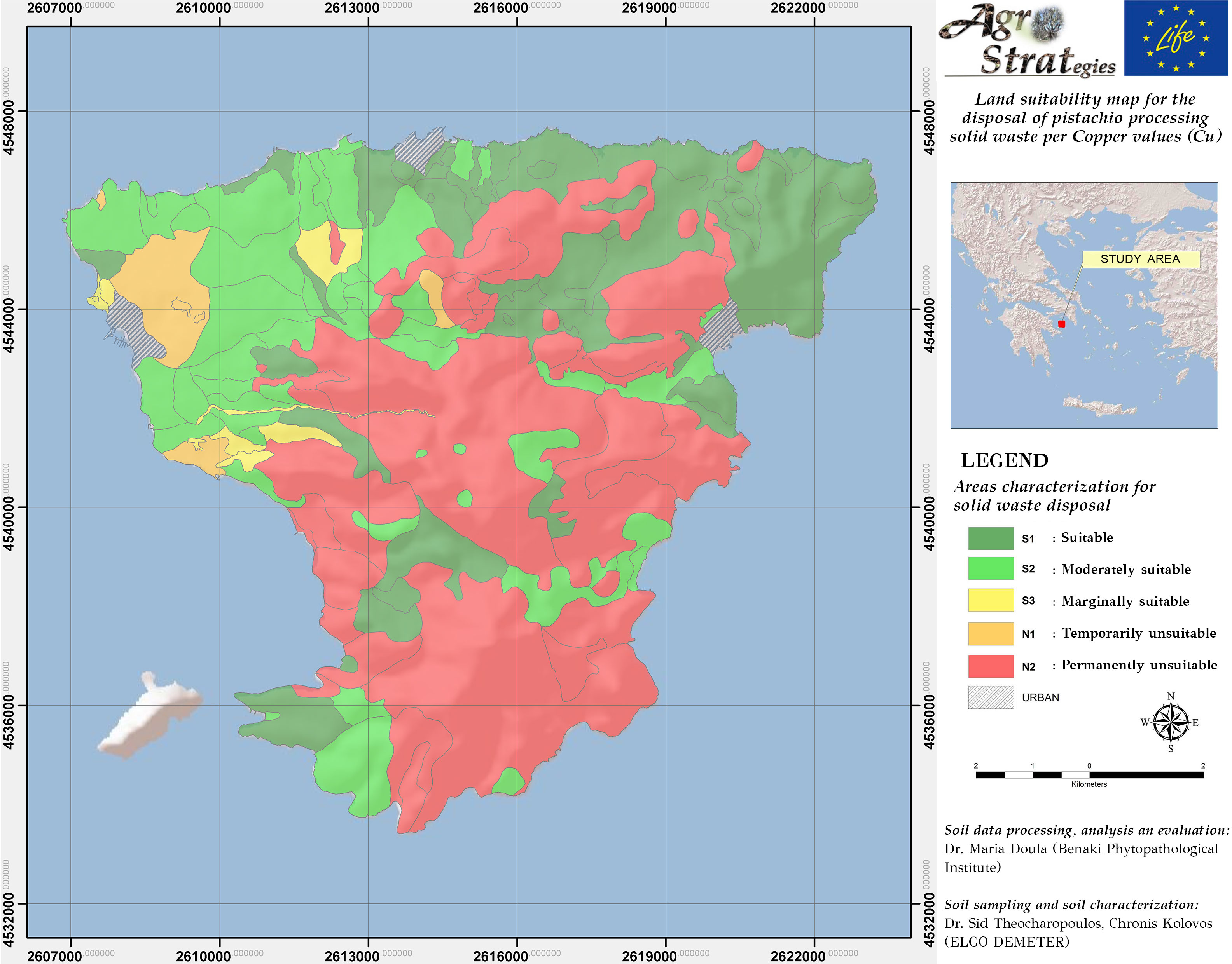
The suitability maps for each soil indicator that follow can be used in combination with the Suitability Map to define suitable and unsuitable areas and to estimate the appropriate amount of waste to be distributed considering the content of Zinc, Copper, Nitrogen, Potassium and Phosphorus in soil.
Map 3: Suitability Map for landspreading of pistachio solid waste as per soil total Nitrogen content
Land Suitability Maps for Pistachio Wastewater Landspreading
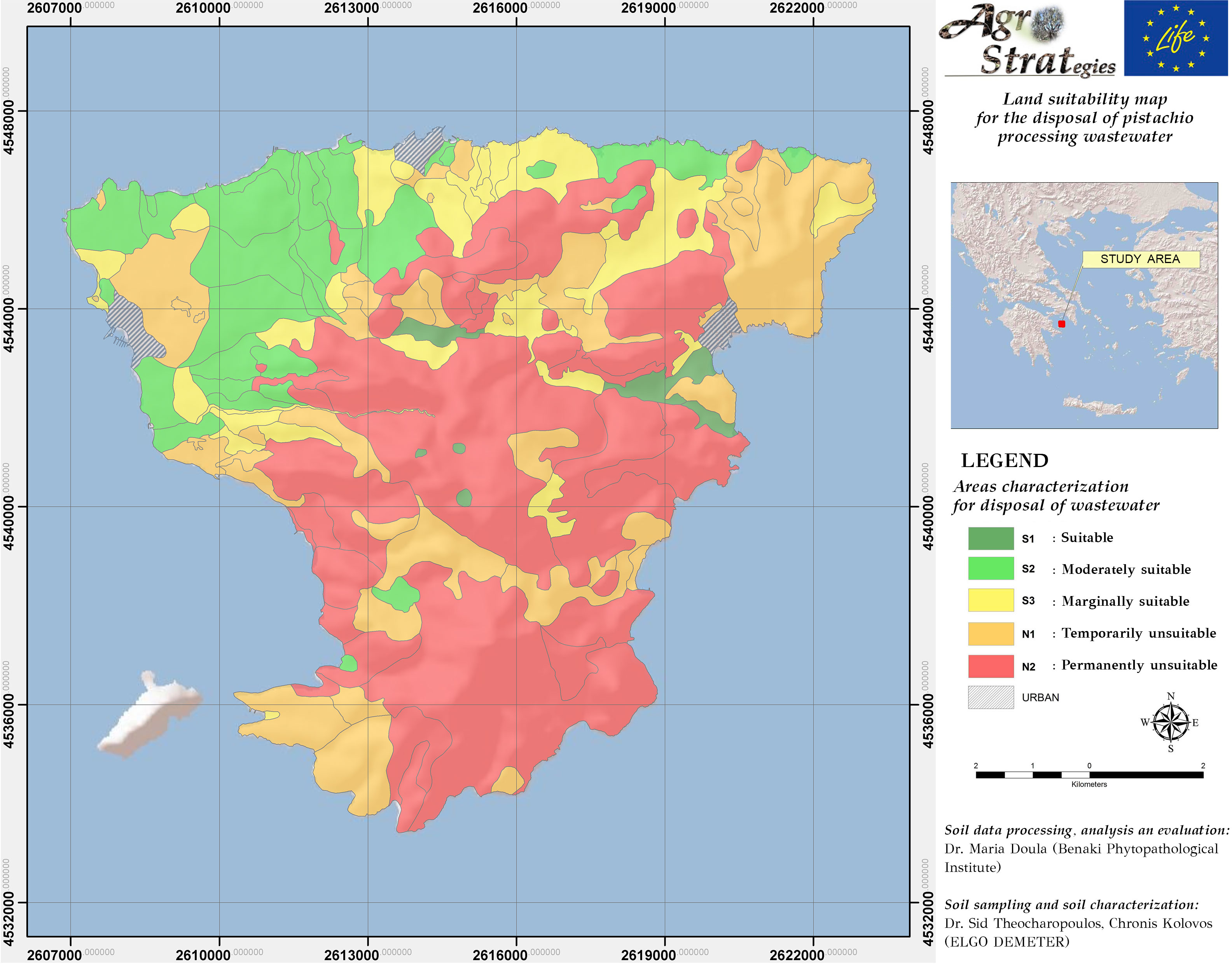
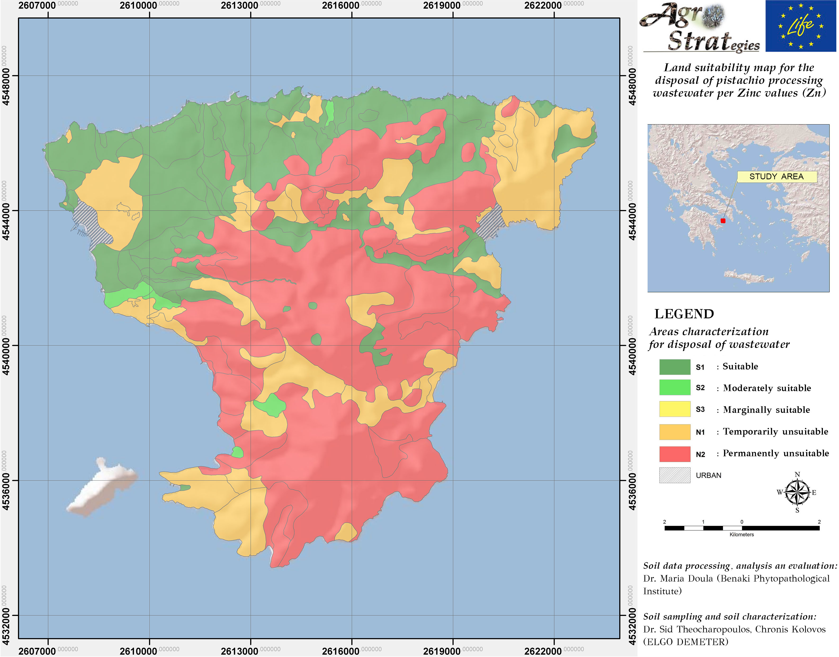
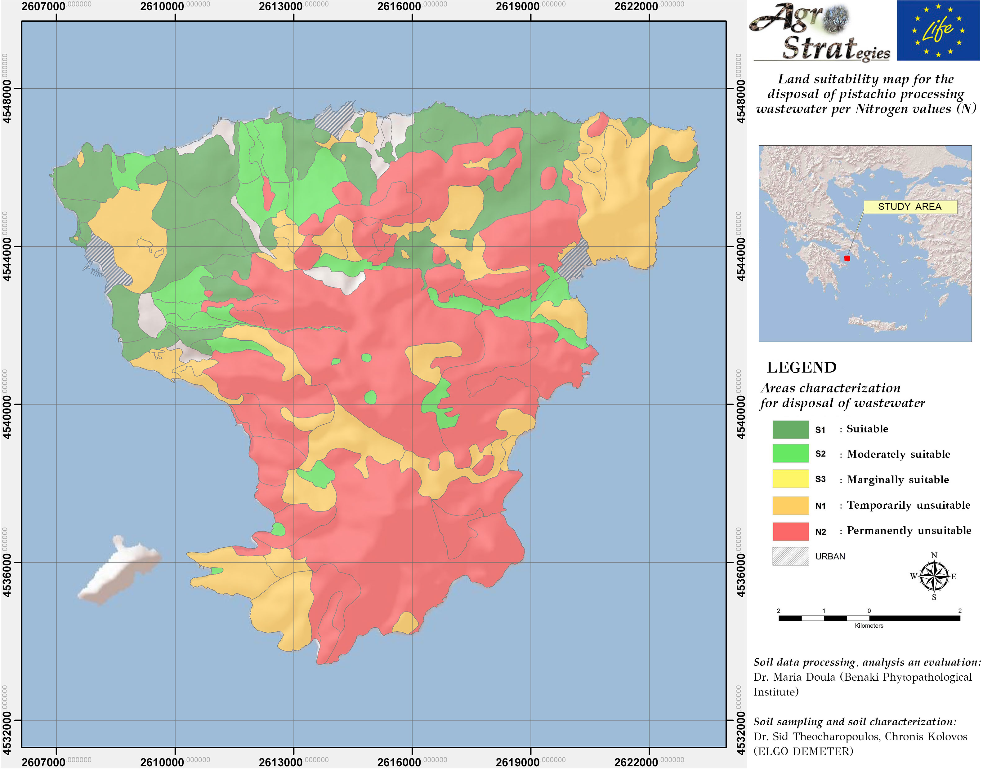
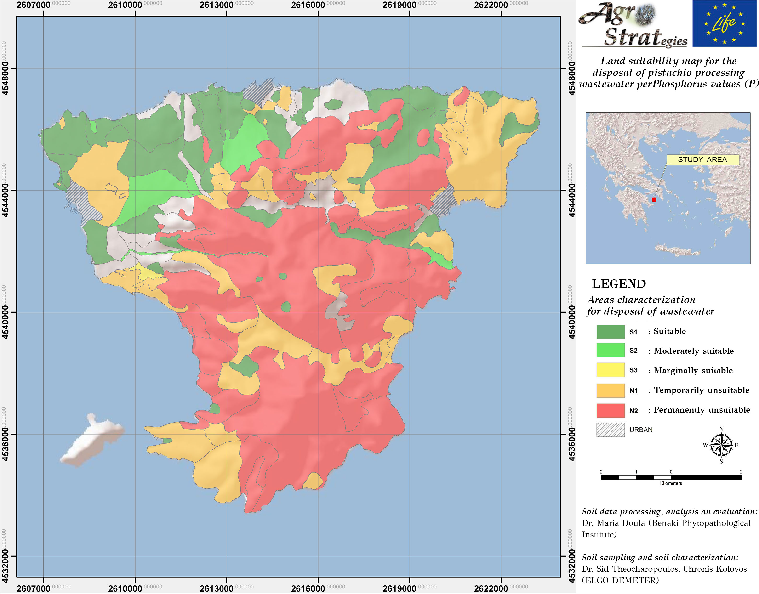
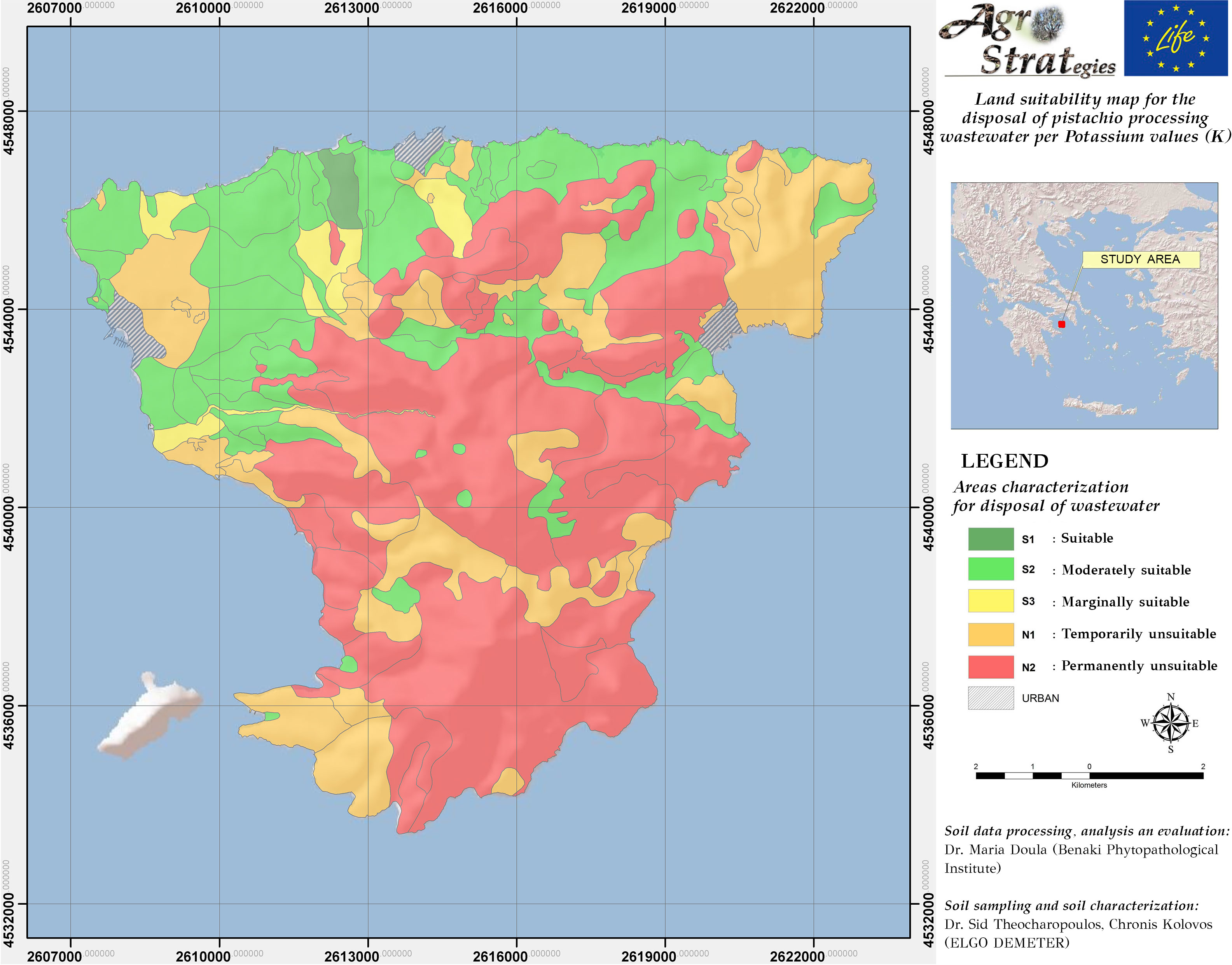
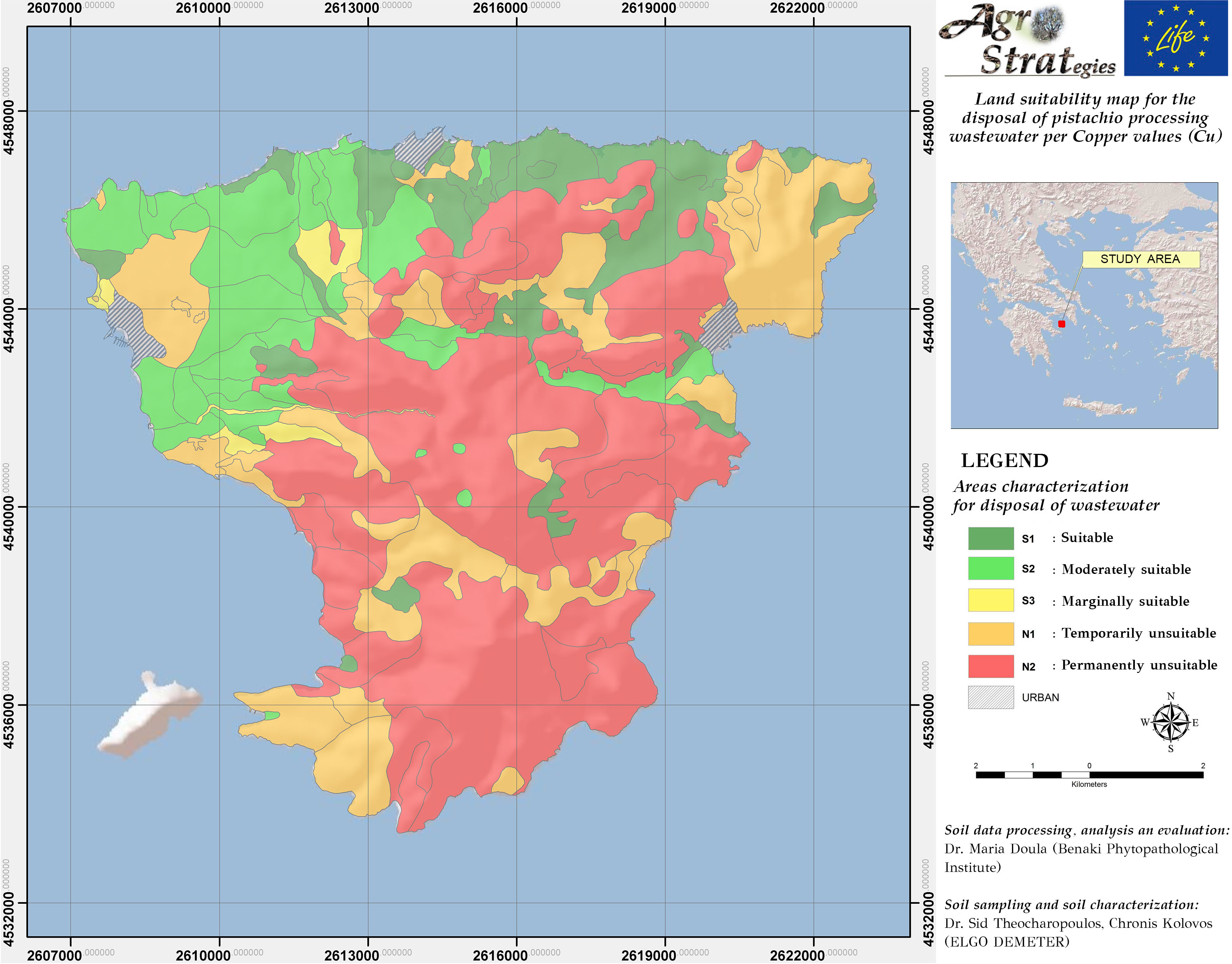
By following the same methodology as for the solid pistachio waste, the respective Suitability Maps were derived for the landspreading of pistachio wastewater.
Map 7: Land Suitability for landspreading of pistachio wastewater
Map 8: Suitability Map for landspreading of pistachio wastewater as per soil available Zinc content
Map 9: Suitability Map for landspreading of pistachio solid waste as per soil total Nitrogen content
References
- Doula, M.K., Sarris, A., Hliaoutakis, A., Kydonakis, A., Papadopoulos, N.S., Argyriou, L. (2016). Building a Strategy for soil protection at local and regional scale-the case ofagricultural wastes landsprading. Environmental Monitoring and Assessment, 188 (3), 1-14.
- Doula, M.K., Kouloumbis, P., Sarris, A., Hliaoutakis, A., Papadopoulos, N.S., Kydonakis, A. (2017). “Reuse of Sewage Sludge on Soil: Terms, Preconditions and Monitoring”, In: Municipal Solid Waste: Management Strategies, Challenges and Future Directions, Tzortzakis, N. (Ed.), NOVA SCIENCE, Chapter 13 (in press).
- Doula, M.K., Moreno, J.L., Tinivella, F., Inglezakis, V., Sarris, A., Komnitsas. K. (2017). “Olive mill waste: recent advances for the sustainable development of olive oil industry”. In:Olive Mill Waste, Recent Advances for Sustainable Management, Galanakis, Ch.M. (Ed.).Elsevier, Academic Press, ISBN: 9780128092248, pp. 29-56.
- Doula, M.K., Sarris, A. (2016). “Soil Environment”. In: Environment and Development, S.Poulopoulos & V. Inglezakis (Eds) pp. 213-286. Elsevier, ISBN: 9780444627339
- Doula, M.K. (2015). “Soil: Threats and Protection. Sustainable Agriculture. In: Social Responsibility and Science in Innovation Economy” (P. Kawalek, R.P. Wierzchoslawski, Eds). Learned Society of KUL & John Paul II Catholic University of Lublin, Polland. Project “Best Practices” in Strategic Transformation of KUL, co-financed by the European Union under the European Social Fund, pp. 193-272.
- Doula, M.K., Kavvadias, V., Elaiopoulos, K. (2013). Proposed soil indicators for Olive Mill Waste (OMW) disposal areas. Water, Air, and Soil Pollution, 224, 1621-1632.
- FAO. (1976). A Framework for Land Evaluation. Soil Resources Management and Conservation Service Land and Water Development Division. FAO Soil Bulletin No. 32. FAO-UNO, Rome.
- MAFF, Dept. of Environment. (1989). Code of Practice for agricultural use of sewage sludge. London.
- Van Gool, D., Maschmedt, D., McKenzie, N. (2008). ‘Conventional Land Evaluation’ in NJ.
- Soil Science Society of America (1986). Utilization, treatment and disposal of waste on land.Proc. of a workshop held in Chicago, 6-7 December, U.S.A.
How data should be cited
Data and Maps should be cited as: Doula M.K. (2015). LIFE AgroStrat project: Processing and Evaluation of soil data for the development of Land Suitability Maps of Aegina Island, Greece for pistachio waste landspreading (https://agrostrat.gr/en/suitabilityMaps).
Contributors
Soil sampling and soil characterization: Dr. S. Theocharopoulos, Ch. Kolovos (ELGO DEMETER)
GIS mapping: A. Hliaoutakis (Institute of Mediterranean Studies-FORTH)