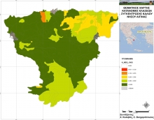
Thematic Maps of Aegina island
The Soil Science Institute of Athens developed a series of thematic maps of Aegina island to be used by local farmers or other inteerested satakeholders and mainly to be used for the developmet of the decision making tool of Action A4. The maps were developed in the framework of Action A2 by Dr. S. Theocharopoulos, Mr. Ch. Kolovos and Mr. D.Arapakis. Maps were also developed by the Technical University of Crete (working team: prof. K. Komnitsas and Dr. G. Bartzas).
See the thematic maps of Aegina here
