Soil, Water Thematic and General Maps of Aegina island
During Action A2, which lasted 18 months, soil and water quality of selected areas in Aegina were monitored. It took place in representative areas where pistachio trees are cultivated, in areas where pistachio wastes are disposed or used as soil additives, in areas that are potentially indirectly affected by the production/processing procedures of pistachio and also in unaffected-non cultivated areas. For this reason, 15 field in Aegina were selected and soil samples were collected periodically (every 2-3 months).
As regards existing water bodies, a carefully designed monitoring system was implemented in the areas under study to monitor the quality of all existing water bodies including seasonal surface streams and groundwater. It is also worth noting that there is a lack of such data for the targeted area, as well as for other similar areas in Greece and in Mediterranean countries where P. vera L. is intensively cultivated and therefore monitoring is considered as a crucial aspect of AgroStrat. Download the map with the water sampling sites.
Download the map of soil sampling sites
Download the map of water sampling sites
Results of the chemical analyses of water samples, collected during the 1st water sampling campaign, are presented here.
General Maps of Aegina Island
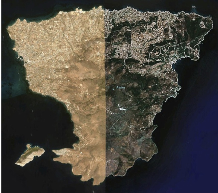
Simplified Map of Aegina Island
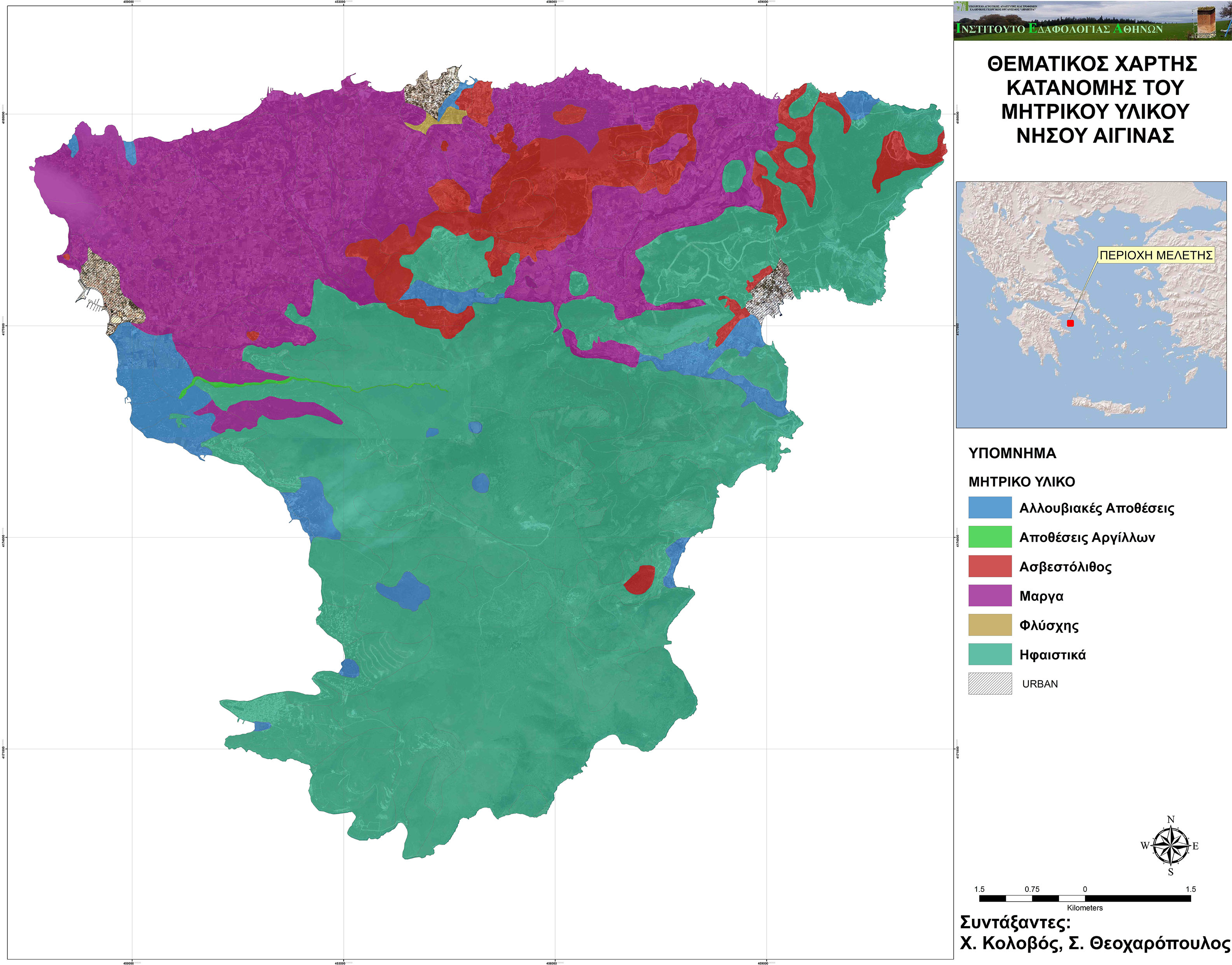
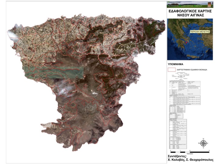
Thematic Maps of Aegina Island (Action A2)
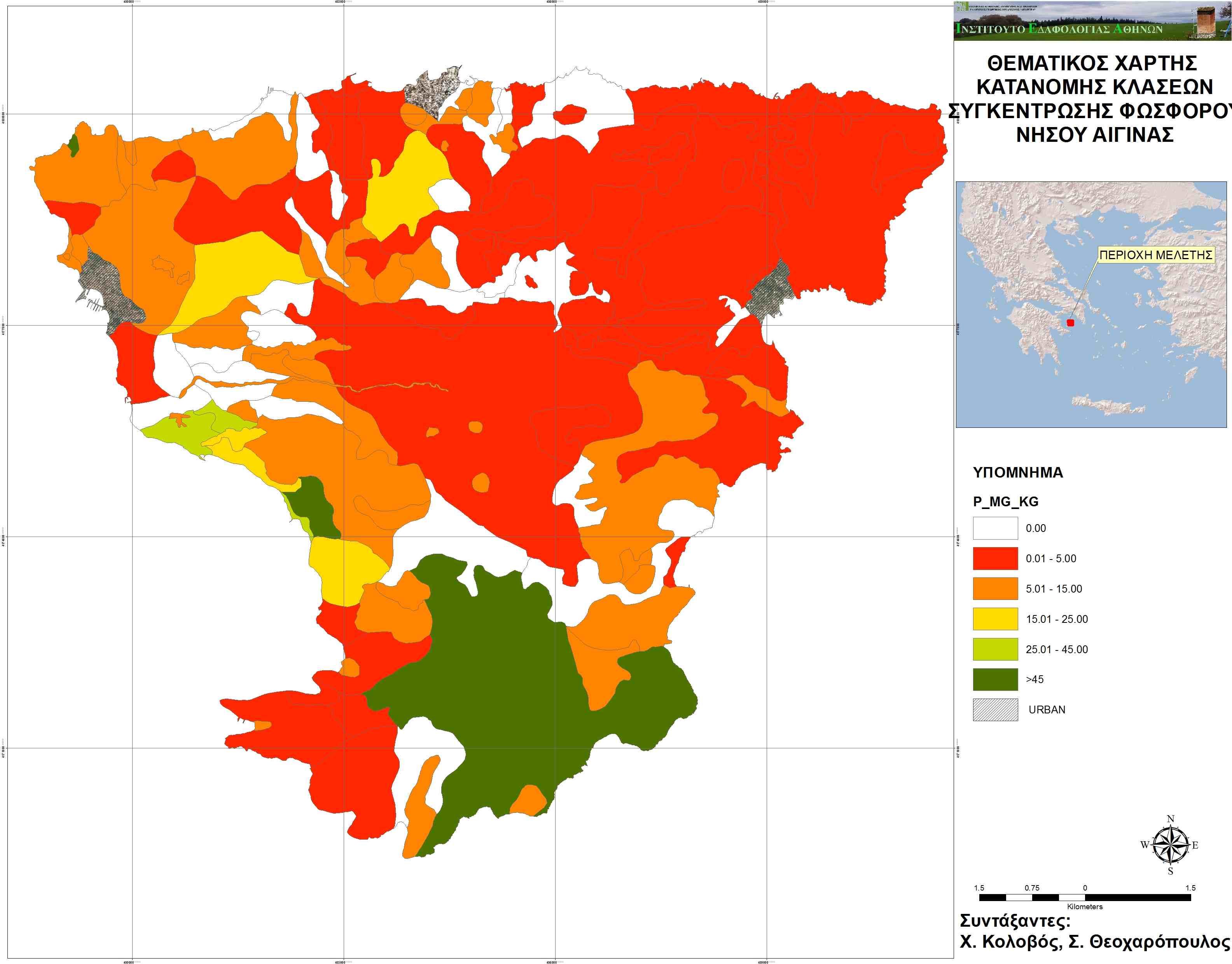
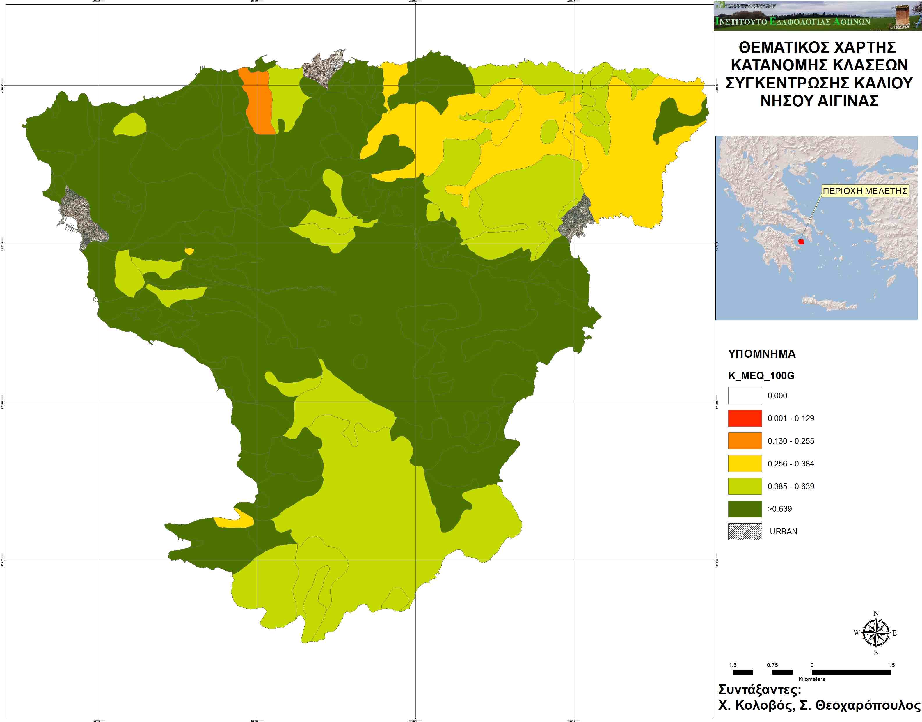
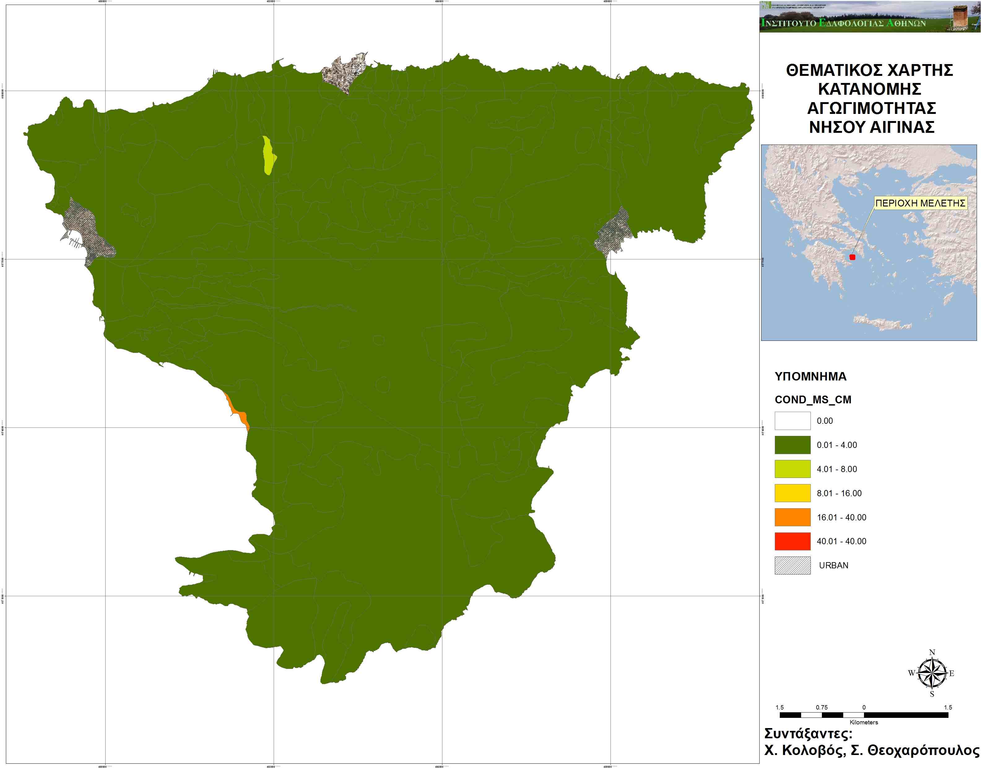
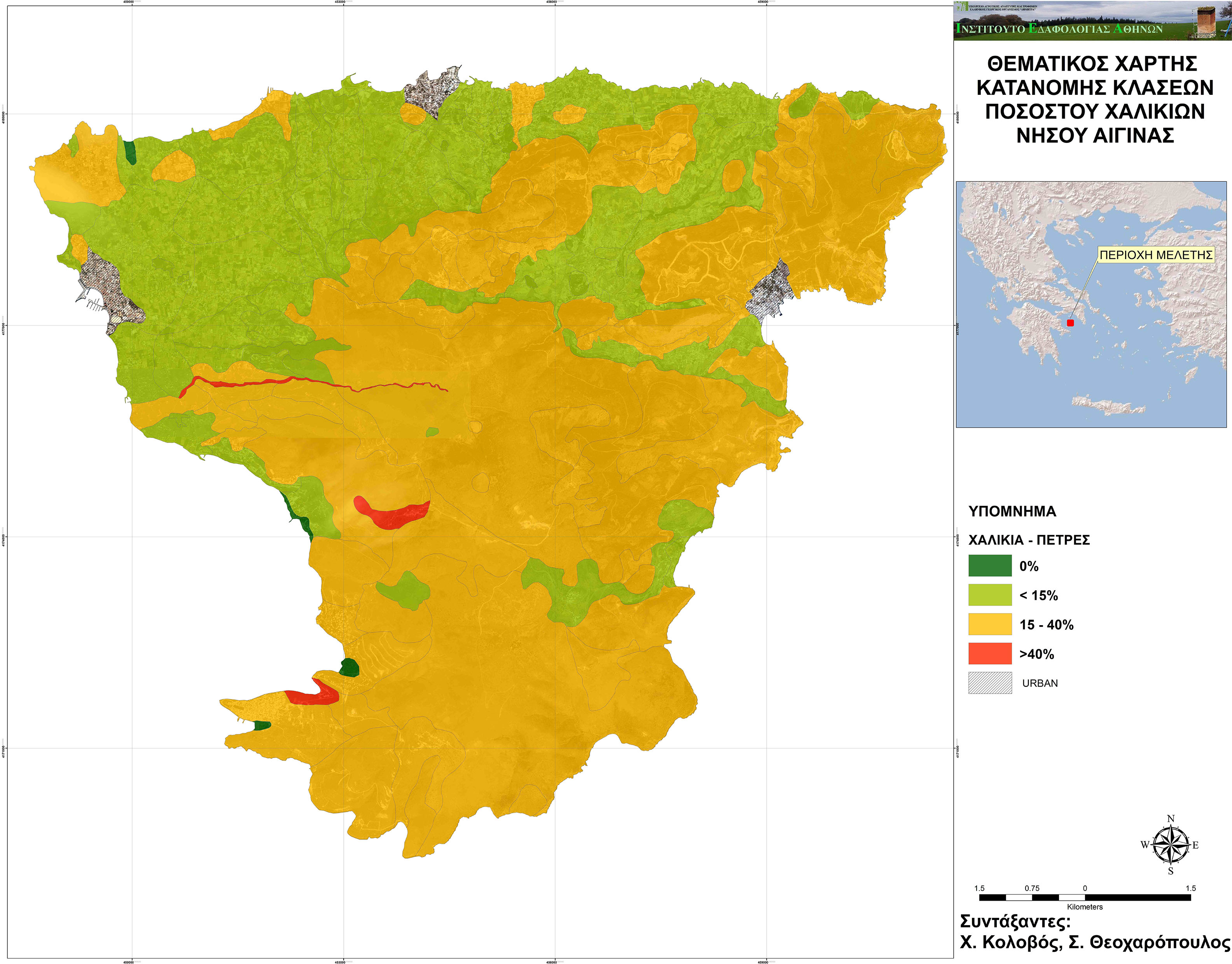
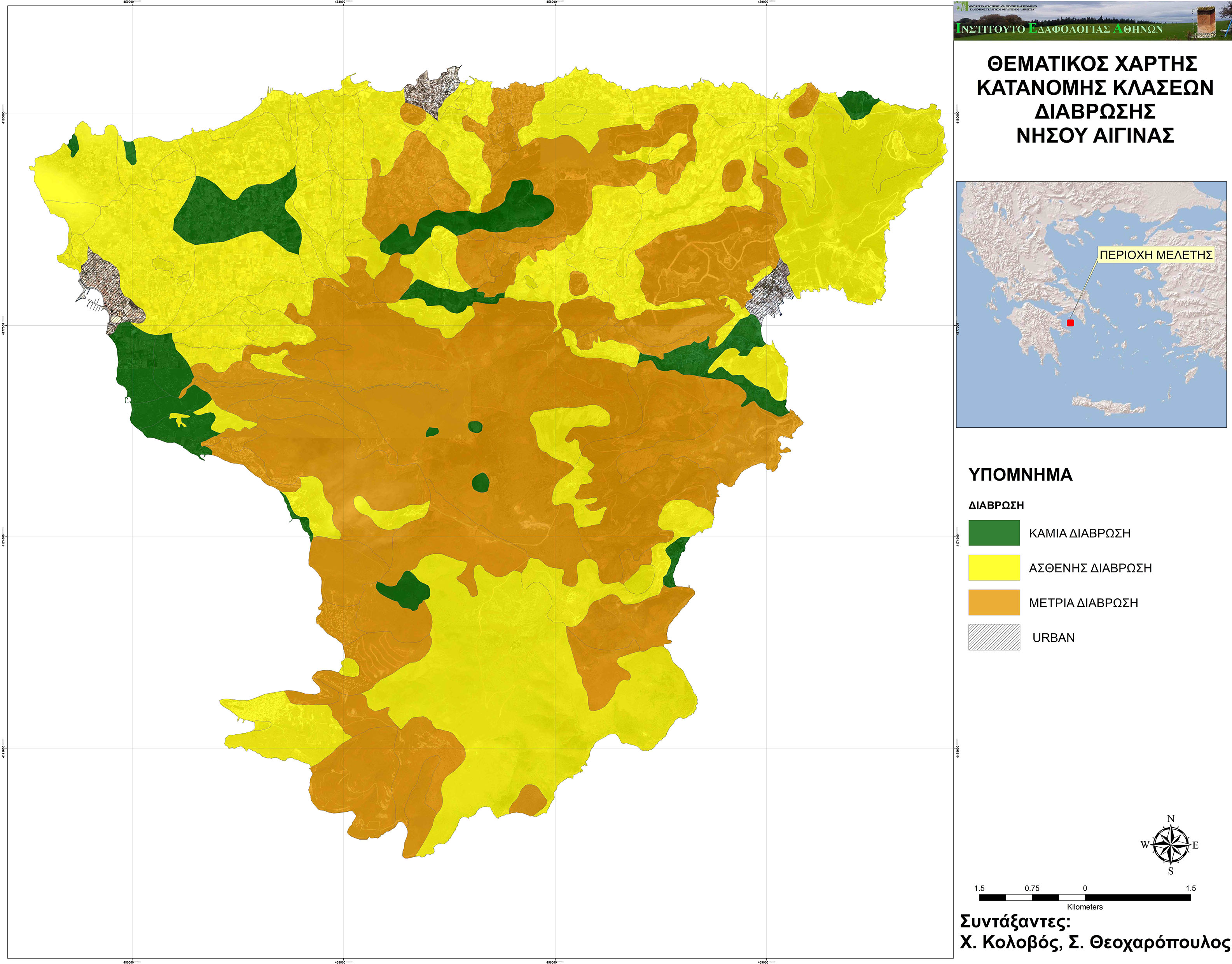
Soil Thematic Maps
(the maps were created by the Soil Science Institute of Athens-ELGO DEMETER, working group: Dr. S. Theocharopoulos, Mr. Ch. Kolovos and Mr. D.Arapakis)
Map of soil electrical conductivity
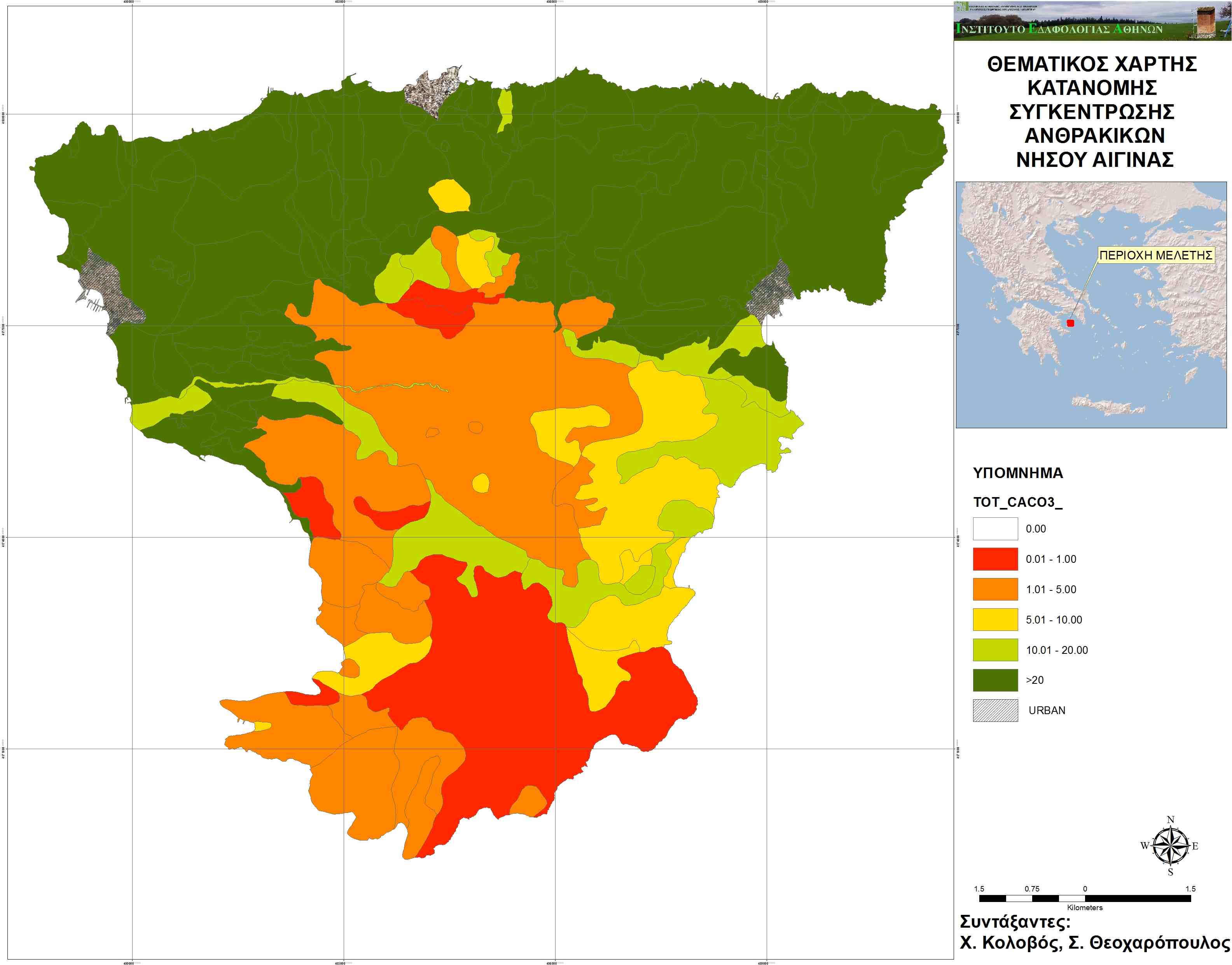
Map of Calcium Carbonate (CaCO3) content


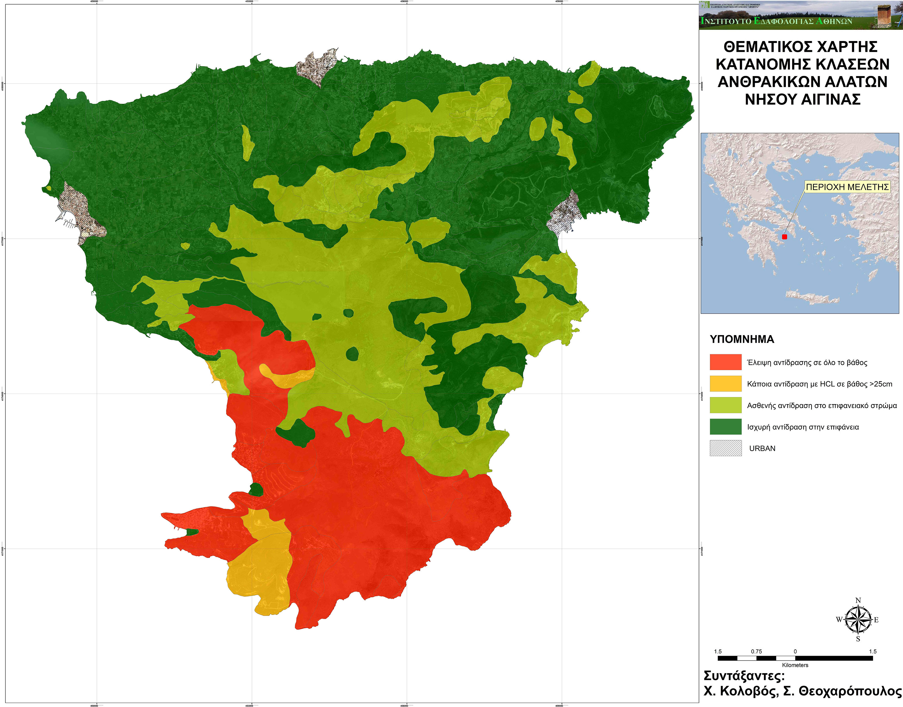
Map of soil carbonate salts content


Maps of water quality
(the maps were created by the the Soil Science Institute of Athens-ELGO DEMETER, working team of Dr. M.Doula and Mr. Ch. Kolovos)
Map of Electrical Conductivity


Map of SAR (Sodium Adsorption Percentage)
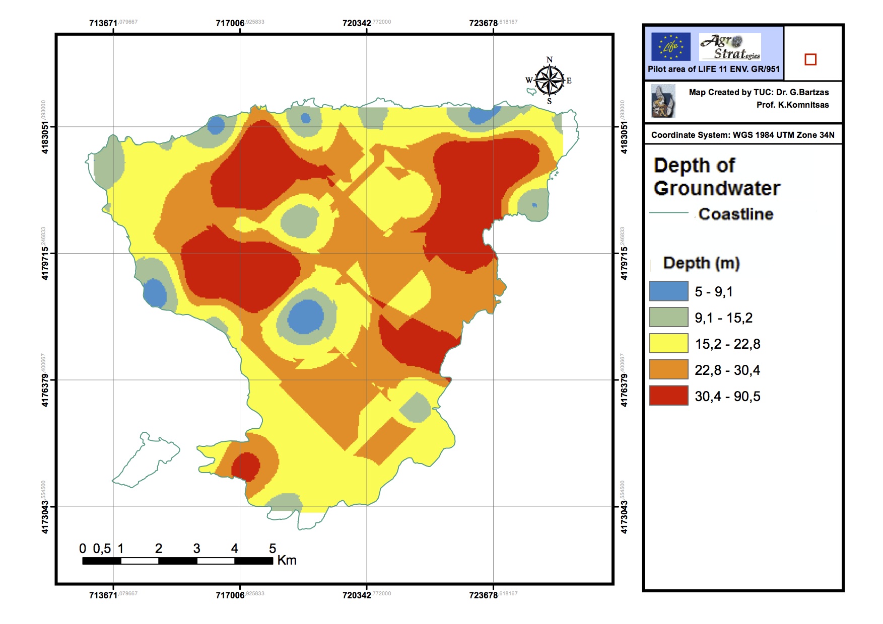
(the maps were created by the Technical University of Crete, working group of Prof. K. Komnitsas, Dr. G. Bartzas).
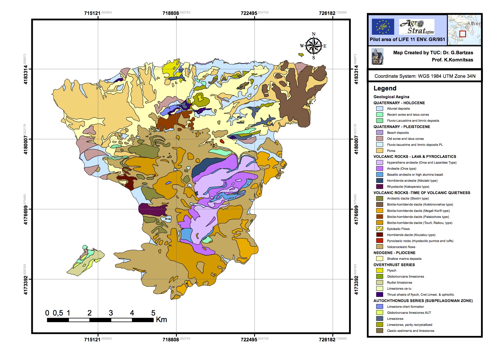
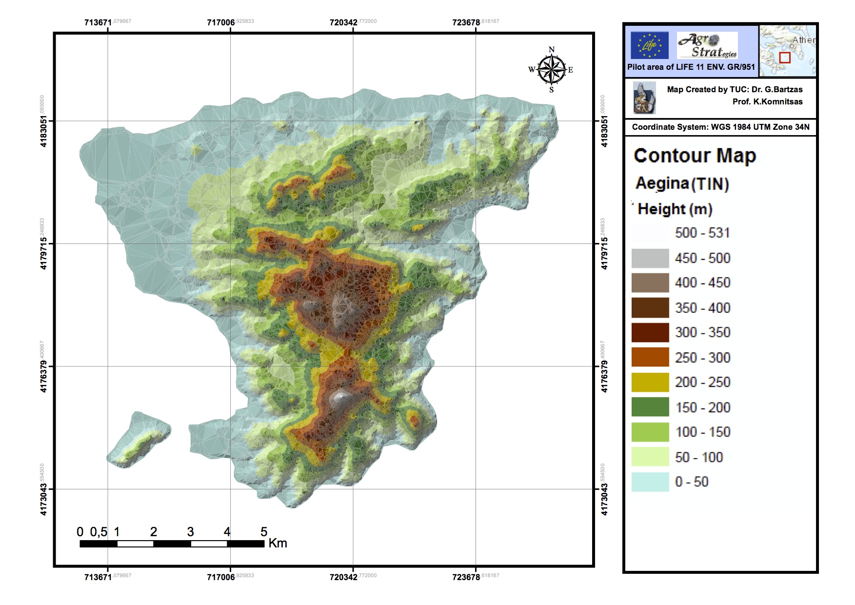
Hydrogeological map of Aegina island
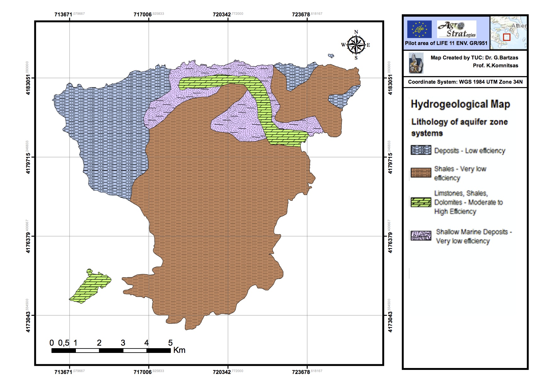
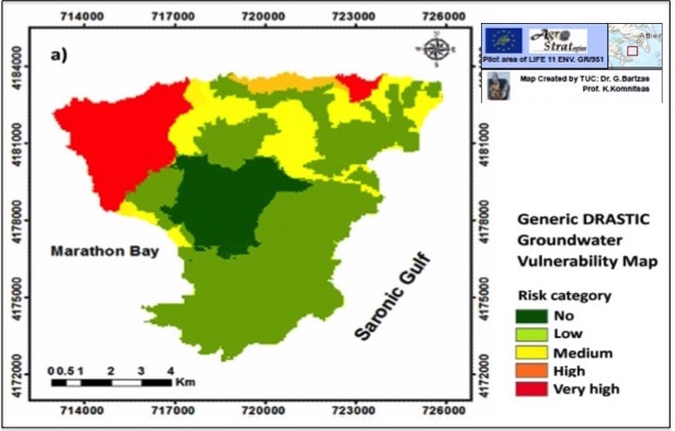
Groundwater Vulnerability Maps (created by using the DRASTIC MODEL)
Generic DRASTIC Groundwater Vulnerability Map

Pesticide DRASTIC Groundwater Vulnerability Map
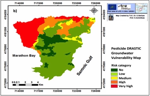
More information on the creation of the Vulnerability Maps can be found in the presentation of G. Bartzas, D. Zaharaki, K. Komnitsas "Evaluation of groundwater vulnerability of Aegina island, Greece using GIS-based methods" - Cyprus 2016, 4th International Conference on Sustainable Solid Waste Management.